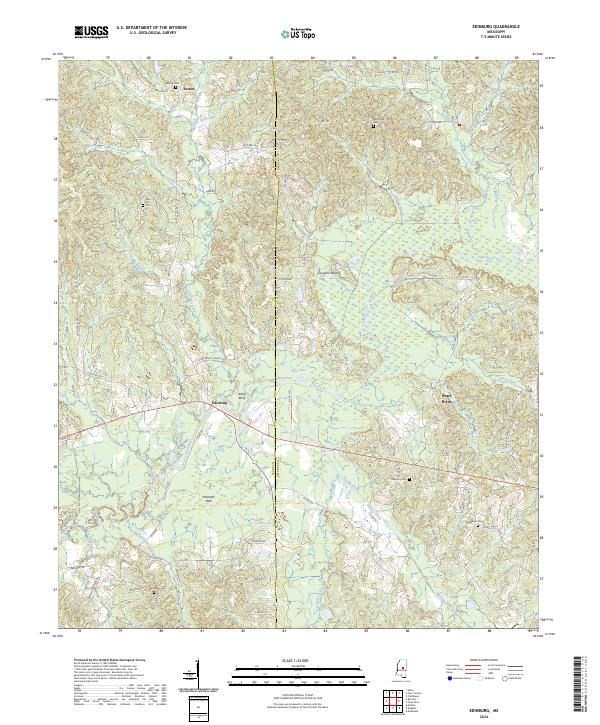
2024 Map of Edinburg
USGS Topo · Published 2024About this map
Edinburg sits at a crossroads along the Pearl River in this modern topographic study of the Neshoba and Leake County line. The settlement pattern is defined by rural road networks like Hooper Mill Creek Rd and Coosa Rd, leading to numerous community anchors including Remus Cem, Harmony Cem, and Mars Hill Cem. The topography is shaped by the river's drainage, with named watercourses like Hooper Mill Creek and Beasha Creek carving through the landscape.
Find a feature on this map
83 named features on this map. Tap any name to fly to it.
Don’t see what you’re looking for? This feature index may not catch every label — zoom into the map to look around manually.
Map Details
Editions of this 2024 Edinburg Map
This is the sole edition of this map. No revisions or reprints were ever made.
Other maps of this area

1953 · Meridian
USGS Topo · 1:250,000

1957 · Meridian
USGS Topo · 1:250,000

1962 · Edinburg
USGS Topo · 1:62,500

1965 · Meridian
USGS Topo · 1:250,000

1972 · Pearl River
USGS Topo · 1:24,000

1972 · Plattsburg
USGS Topo · 1:24,000

1972 · McAfee
USGS Topo · 1:24,000

1972 · Madden
USGS Topo · 1:24,000
1972 · McDonald
USGS Topo · 1:24,000

1984 · Carthage
USGS Topo · 1:100,000