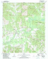
1989 Map of Edinburg
USGS Topo · Published 1989About this map
Choctaw Indian Reservation lands dominate the eastern half of this landscape where the Pearl River snakes through the borderlands of Leake and Neshoba counties. The settlement of Edinburg serves as a local hub, featuring the Edinburg High Sch and a network of roads that follow an Old Grade and Old Railroad, tracing the former paths of industry through the river valley. The map is particularly dense with rural religious sites, including Old Canaan Ch, New Harmony Ch, and New Testament Holiness Ch, which reflect the social fabric of these small communities during the late 20th century. Terrain features like Coughlin Mound and the swampy reaches of Palmetto Flats suggest a landscape deeply shaped by the river's hydrology, while numerous family-named branches like Hooper Mill Creek and Sullivan Branch feed into the main waterway.
Find a feature on this map
38 named features on this map. Tap any name to fly to it.
Don’t see what you’re looking for? This feature index may not catch every label — zoom into the map to look around manually.
Map Details
Editions of this 1989 Edinburg Map
This is the sole edition of this map. No revisions or reprints were ever made.
Other maps of this area

1953 · Meridian
USGS Topo · 1:250,000

1957 · Meridian
USGS Topo · 1:250,000

1962 · Edinburg
USGS Topo · 1:62,500

1965 · Meridian
USGS Topo · 1:250,000

1972 · Pearl River
USGS Topo · 1:24,000

1972 · Plattsburg
USGS Topo · 1:24,000

1972 · McAfee
USGS Topo · 1:24,000

1972 · Madden
USGS Topo · 1:24,000
1972 · McDonald
USGS Topo · 1:24,000

1984 · Carthage
USGS Topo · 1:100,000