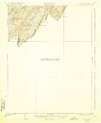
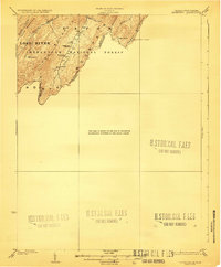
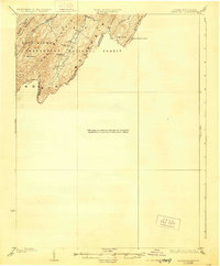
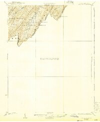
1923 Map of Edinburg
USGS Topo · Published 1943About this map
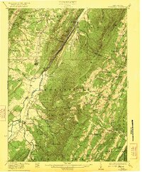
The George Washington National Forest dominates this survey, where the rugged topography of the Ridge-and-Valley province defines the border between Virginia and West Virginia. Much of the mapped area is high-elevation forest and steep terrain, punctuated by features like Sugar Knob and the Forest Service Lookout on Paddy Mountain. Settlement is sparse and largely confined to the valleys where water and slightly more level ground are available.
Find a feature on this map
21 named features on this map. Tap any name to fly to it.
Don’t see what you’re looking for? This feature index may not catch every label — zoom into the map to look around manually.
Map Details
Editions of this 1923 Edinburg Map
5 editions found

Other maps of this area

1891 · Romney
USGS Topo · 1:125,000

1892 · Woodstock
USGS Topo · 1:125,000

1893 · Luray
USGS Topo · 1:125,000

1894 · Winchester
USGS Topo · 1:125,000

1905 · Luray
USGS Topo · 1:125,000

1920 · Moorefield
USGS Topo · 1:62,500

1921 · Orkney Springs
USGS Topo · 1:48,000

1921 · Moorefield
USGS Topo · 1:48,000
1922 · Moorefield
USGS Topo · 1:62,500

1922 · Wardensville
USGS Topo · 1:62,500