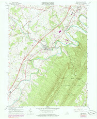
1966 Map of Edinburg
USGS Topo · Published 1984About this map
The Shenandoah River North Fork meanders through the heart of the valley, carving the dramatic serpentine loops known as the Seven Bends. This landscape is defined by the juxtaposition of the fertile valley floor, home to settlements like Edinburg and Woodstock, and the steep, forested slopes of Short Mountain and Powell Mountain within the George Washington National Forest. The Southern railroad line runs parallel to the river, anchoring a corridor of historical development that includes Massanutten Military Academy and smaller communities such as Lantz Mills and Hawkinstown. Local history is preserved in the numerous rural cemeteries and churches, including Wakemans Grove Cem and Wesley Chapel, which mark the generational roots of the area. The map also captures 20th-century additions like the Drive-in Theater and Edinburg Reservoir, reflecting the evolving infrastructure of Shenandoah County.
Find a feature on this map
45 named features on this map. Tap any name to fly to it.
Don’t see what you’re looking for? This feature index may not catch every label — zoom into the map to look around manually.
Map Details
Editions of this 1966 Edinburg Map
Other maps of this area

1892 · Woodstock
USGS Topo · 1:125,000

1893 · Luray
USGS Topo · 1:125,000

1905 · Luray
USGS Topo · 1:125,000

1923 · Edinburg
USGS Topo · 1:62,500

1929 · Stony Man
USGS Topo · 1:48,000

1933 · Stony Man
USGS Topo · 1:62,500

1942 · Mt Jackson
USGS Topo · 1:62,500

1946 · Mt Jackson
USGS Topo · 1:62,500

1947 · Mt Jackson
USGS Topo · 1:62,500

1947 · Strasburg
USGS Topo · 1:62,500