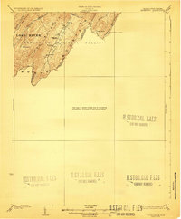
1923 Map of Edinburg
USGS Topo · Published 1923About this map
Shenandoah National Forest dominates this 1921 survey, where the border between West Virginia and Virginia follows the high ridges of North Mountain. The landscape is defined by the sharp parallel ridges of Lost River Mountain and Long Mountain, creating a series of deep valleys where small mountain communities persisted. These valleys were served by institutions like the Heishman School and Mt Vernon Church, situated near the headwaters of Trout Run.
Find a feature on this map
21 named features on this map. Tap any name to fly to it.
Don’t see what you’re looking for? This feature index may not catch every label — zoom into the map to look around manually.
Map Details
Editions of this 1923 Edinburg Map
5 editions found

Other maps of this area

1891 · Romney
USGS Topo · 1:125,000

1892 · Woodstock
USGS Topo · 1:125,000

1893 · Luray
USGS Topo · 1:125,000

1894 · Winchester
USGS Topo · 1:125,000

1905 · Luray
USGS Topo · 1:125,000

1920 · Moorefield
USGS Topo · 1:62,500

1921 · Orkney Springs
USGS Topo · 1:48,000

1921 · Moorefield
USGS Topo · 1:48,000

1922 · Moorefield
USGS Topo · 1:62,500

1922 · Wardensville
USGS Topo · 1:62,500