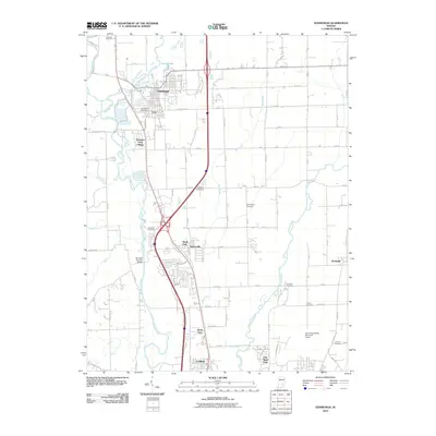
2010 Map of Edinburgh
USGS Topo · Published 2010About this map
The Big Blue River and Driftwood River converge near the town of Edinburgh, creating a complex network of waterways that defined early settlement patterns in this part of Indiana. This early 21st-century survey documents the transition between established communities and the expansion of the Columbus Bakalar Municipal Airport to the south. Local heritage is preserved in several family and community burial grounds, including Tannehill Cemetery, Steenbarger Cemetery, and Treadway Cemetery, which are scattered throughout the agricultural landscape. The presence of the Tannehill Covered Bridge over the Driftwood River serves as a significant landmark of historical engineering, while smaller communities like Cuba, Taylorsville, and Lowell appear alongside modern infrastructure and suburban developments such as Pleasant View Village and Northcliff.
Find a feature on this map
76 named features on this map. Tap any name to fly to it.
Don’t see what you’re looking for? This feature index may not catch every label — zoom into the map to look around manually.
Map Details
Editions of this 2010 Edinburgh Map
This is the sole edition of this map. No revisions or reprints were ever made.
Other maps of this area

1942 · Franklin
USGS Topo · 1:125,000

1942 · Columbus
USGS Topo · 1:125,000

1947 · Franklin
USGS Topo · 1:62,500

1947 · Hope
USGS Topo · 1:24,000

1948 · Franklin
USGS Topo · 1:24,000

1948 · Edinburg
USGS Topo · 1:24,000

1948 · New Bellsville
USGS Topo · 1:24,000

1948 · Hope
USGS Topo · 1:24,000

1948 · Nineveh
USGS Topo · 1:24,000

1948 · Lewis Creek
USGS Topo · 1:24,000