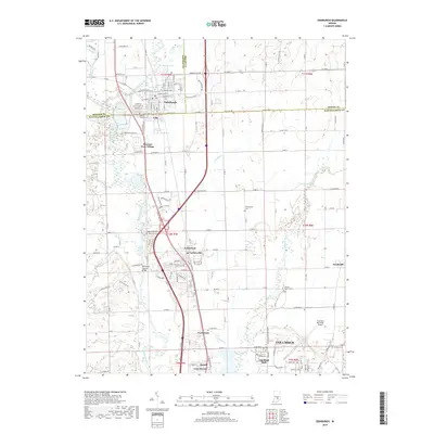
2019 Map of Edinburgh
USGS Topo · Published 2019About this map
The Driftwood River and Flatrock River converge in this part of south-central Indiana, shaping a landscape defined by alluvial plains and established transportation corridors. Edinburgh anchors the northern boundary, where the Big Blue River meets Sugar Creek, while the city of Columbus expands from the southeast. A notable landmark of local heritage is the Tannehill Covered Bridge, situated near the Tannehill Cem along the river's edge. The industrial and logistical character of the region is evident in the presence of the Louisville & Indiana Railroad and the Columbus Municipal Airport. Smaller residential developments like Pleasant View Village and Taylorsville illustrate the transition from the concentrated historic core of Edinburgh to the modern suburban reaches of Columbus.
Find a feature on this map
95 named features on this map. Tap any name to fly to it.
Don’t see what you’re looking for? This feature index may not catch every label — zoom into the map to look around manually.
Map Details
Editions of this 2019 Edinburgh Map
This is the sole edition of this map. No revisions or reprints were ever made.
Other maps of this area

1942 · Franklin
USGS Topo · 1:125,000

1942 · Columbus
USGS Topo · 1:125,000

1947 · Franklin
USGS Topo · 1:62,500

1947 · Hope
USGS Topo · 1:24,000

1948 · Franklin
USGS Topo · 1:24,000

1948 · Edinburg
USGS Topo · 1:24,000

1948 · New Bellsville
USGS Topo · 1:24,000

1948 · Hope
USGS Topo · 1:24,000

1948 · Nineveh
USGS Topo · 1:24,000

1948 · Lewis Creek
USGS Topo · 1:24,000