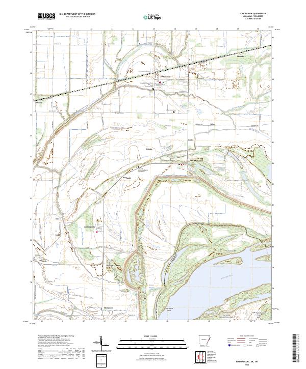
2024 Map of Edmondson
USGS Topo · Published 2024About this map
Edmondson and Proctor anchor this detailed study of the Arkansas Delta, where the landscape is defined by the intricate hydrology of the Mississippi River and its ancient floodplains. The map reveals a dense network of drainage and bayous, including Fifteenmile Bayou and Tenmile Bayou, which weave through agricultural tracts and small rural communities. For genealogists and local historians, the inclusion of sites like Campbell Chapel African Methodist Episcopal Cem and True Vine Missionary Baptist Church Cem offers a precise look at the cultural and spiritual centers of these Delta settlements.
Find a feature on this map
57 named features on this map. Tap any name to fly to it.
Don’t see what you’re looking for? This feature index may not catch every label — zoom into the map to look around manually.
Map Details
Editions of this 2024 Edmondson Map
This is the sole edition of this map. No revisions or reprints were ever made.
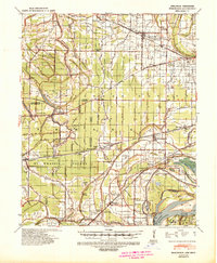
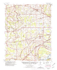
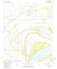
Historical Maps of Neuhardt Through Time
4 maps found