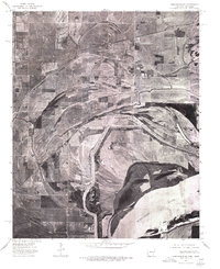
1975 Map of Edmondson SE
USGS Topo · Published 1976About this map
Mississippi River floodplains dominate this 1975 orthophotoquad, which captures the agricultural geometry and meandering waterways of Crittenden County just across the state line from Tennessee. The imagery reveals the sharp contrast between the dense woodlands bordering the river's edge and the vast, cleared fields of the Delta interior. Small clusters of development at Edmondson and Proctor appear along established transportation routes, while smaller rural junctions like Neuhardt and Midway Corner sit within the grid of drainage ditches and farm roads. The path of Fifteenmile Bayou snakes across the northern portion of the sheet, providing a natural drainage corridor through the fertile lowlands. This specialized photo-based map, produced by the U.S. Geological Survey, provides an unfiltered view of land use, including clearings at Simsboro and Thompson, illustrating the intensive farming patterns characteristic of this Mississippi Embayment region.
Find a feature on this map
8 named features on this map. Tap any name to fly to it.
Don’t see what you’re looking for? This feature index may not catch every label — zoom into the map to look around manually.
Map Details
Editions of this 1975 Edmondson SE Map
This is the sole edition of this map. No revisions or reprints were ever made.
Other maps of this area

1908 · Lake Cormorant
USGS Topo · 1:24,000

1912 · Lake Cormorant
USGS Topo · 1:31,680

1916 · Memphis
USGS Topo · 1:62,500

1925 · Memphis
USGS Topo · 1:48,000

1927 · Memphis
USGS Topo · 1:62,500

1931 · Horseshoe Lake
USGS Topo · 1:62,500

1932 · Horn Lake
USGS Topo · 1:48,000

1935 · Horn Lake
USGS Topo · 1:62,500

1939 · Horseshoe Lake
USGS Topo · 1:62,500

1939 · Edmondson
USGS Topo · 1:62,500