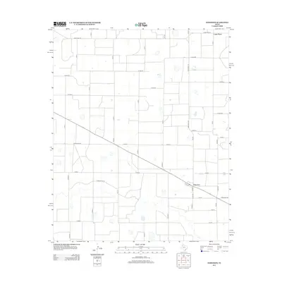
2012 Map of Edmonson
USGS Topo · Published 2012About this map
Edmonson serves as the primary hub for this agricultural landscape in the Texas Panhandle, positioned along a diagonal roadway that cuts through the region's rigid grid system. The town's small street network, including W 2nd St and S Merrill, anchors a vast expanse of farmland defined by an extensive series of section roads. The northern reach of the survey is marked by the community of Center Plains, connected to the surrounding countryside by arterial routes such as Ranch Road 145 and FM-1424. The terrain is characterized by numerous small depressions and drainage features, including the path of Running River Dr, which hints at the hydrology of the Llano Estacado. This 2012 survey illustrates the modern layout of rural Hale County, where ranch roads like Ranch Road 788 provide essential links between remote farmsteads and the central grain and transport facilities in town.
Find a feature on this map
34 named features on this map. Tap any name to fly to it.
Don’t see what you’re looking for? This feature index may not catch every label — zoom into the map to look around manually.
Map Details
Editions of this 2012 Edmonson Map
This is the sole edition of this map. No revisions or reprints were ever made.
Other maps of this area

1954 · Plainview
USGS Topo · 1:250,000

1954 · Clovis
USGS Topo · 1:250,000

1958 · Clovis
USGS Topo · 1:250,000

1958 · Plainview
USGS Topo · 1:250,000

1965 · Hart
USGS Topo · 1:24,000

1965 · Edmonson NE
USGS Topo · 1:24,000

1965 · Kress West
USGS Topo · 1:24,000

1965 · Edmonson
USGS Topo · 1:24,000

1965 · Hilburn
USGS Topo · 1:24,000

1965 · Center Plains School
USGS Topo · 1:24,000