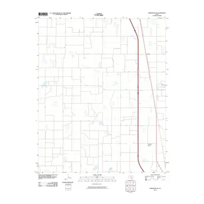
2010 Map of Edmonson NE
USGS Topo · Published 2010About this map
Eunice and its surrounding agricultural landscape are defined by a rigid grid of county roads and vital transportation corridors in this high plains region. The map illustrates a highly organized rural infrastructure where irrigation and aviation serve the local farming economy. A notable landmark is the Joe Vaughn Spraying Airport, which underscores the importance of aerial application in the management of the area's crops. The terrain is crisscrossed by a network of local thoroughfares including Co RD S, Co RD T, and FM 928, which link the small settlement to the broader region. This survey provides a clear view of the land division and the specialized facilities required for modern agriculture in Swisher County during the early twenty-first century.
Find a feature on this map
9 named features on this map. Tap any name to fly to it.
Don’t see what you’re looking for? This feature index may not catch every label — zoom into the map to look around manually.
Map Details
Editions of this 2010 Edmonson NE Map
This is the sole edition of this map. No revisions or reprints were ever made.
Other maps of this area

1954 · Plainview
USGS Topo · 1:250,000

1958 · Plainview
USGS Topo · 1:250,000

1965 · Edmonson NE
USGS Topo · 1:24,000

1965 · Kress West
USGS Topo · 1:24,000

1965 · Tulia
USGS Topo · 1:24,000

1965 · Edmonson
USGS Topo · 1:24,000

1965 · Lakeview
USGS Topo · 1:24,000

1965 · Center Plains School
USGS Topo · 1:24,000

1968 · Tule Lake
USGS Topo · 1:24,000

1969 · Kress East
USGS Topo · 1:24,000