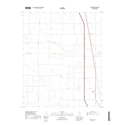
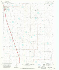
2019 Map of Edmonson NE
USGS Topo · Published 2019About this map
South Tule Draw meanders across this High Plains landscape in Swisher County, carving a subtle drainage through an otherwise orderly grid of agricultural roads. The small settlement of Eunice sits along the eastern edge of the quadrangle, positioned where the local road network intersects with major transit corridors. This 2019 survey illustrates the modern intersection of aviation and agriculture, evidenced by the Joe Vaughn Spraying Airport located in the southeastern quadrant. The terrain is defined by its playa lakes and depressions, characteristic of the Texas Panhandle, while a series of county roads such as Co Rd S and Co Rd 10 divide the territory into large, rectangular sections. State and county transit routes, including FM 928 and Ranch Rd 3141, provide the primary infrastructure for this sparsely populated ranching and farming region.
Find a feature on this map
18 named features on this map. Tap any name to fly to it.
Don’t see what you’re looking for? This feature index may not catch every label — zoom into the map to look around manually.
Map Details
Editions of this 2019 Edmonson NE Map
This is the sole edition of this map. No revisions or reprints were ever made.
Other maps of this area

1954 · Plainview
USGS Topo · 1:250,000

1958 · Plainview
USGS Topo · 1:250,000
1965 · Edmonson NE
USGS Topo · 1:24,000
1965 · Kress West
USGS Topo · 1:24,000
1965 · Tulia
USGS Topo · 1:24,000
1965 · Edmonson
USGS Topo · 1:24,000
1965 · Lakeview
USGS Topo · 1:24,000
1965 · Center Plains School
USGS Topo · 1:24,000
1968 · Tule Lake
USGS Topo · 1:24,000
1969 · Kress East
USGS Topo · 1:24,000