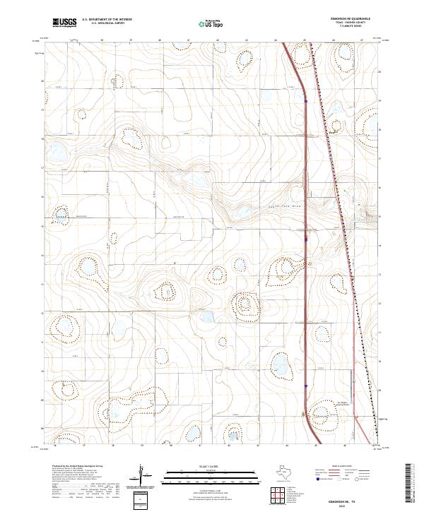
2022 Map of Edmonson NE
USGS Topo · Published 2022About this map
The agricultural landscape of Swisher County is defined by a dense grid of county roads and ranch-to-market routes that support the region's ranching economy. Modern transport corridors, including a major interstate and rail line, cut north-to-south through the terrain, passing through Eunice. The topography is shaped by the winding course of South Tule Draw, which meanders across the central portion of the map. Industry and local infrastructure are represented by specialized sites such as the Joe Vaughn Spraying Airport in the south and the Tulia Feedlot Reservoir near the eastern edge. This survey reflects the persistence of High Plains farming practices, where the geometric precision of local roads like Ranch Rd 3141 and Fm 928 overlays the natural drainage patterns of the Texas Panhandle.
Find a feature on this map
20 named features on this map. Tap any name to fly to it.
Don’t see what you’re looking for? This feature index may not catch every label — zoom into the map to look around manually.
Map Details
Editions of this 2022 Edmonson NE Map
This is the sole edition of this map. No revisions or reprints were ever made.
Other maps of this area

1954 · Plainview
USGS Topo · 1:250,000

1958 · Plainview
USGS Topo · 1:250,000

1965 · Edmonson NE
USGS Topo · 1:24,000

1965 · Kress West
USGS Topo · 1:24,000

1965 · Tulia
USGS Topo · 1:24,000

1965 · Edmonson
USGS Topo · 1:24,000

1965 · Lakeview
USGS Topo · 1:24,000

1965 · Center Plains School
USGS Topo · 1:24,000

1968 · Tule Lake
USGS Topo · 1:24,000

1969 · Kress East
USGS Topo · 1:24,000