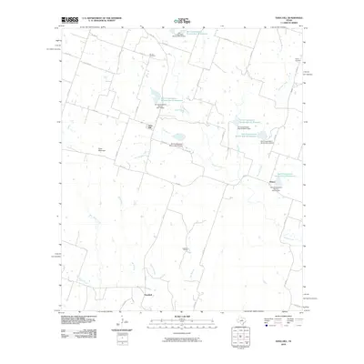
2010 Map of Edna Hill
USGS Topo · Published 2010About this map
Edna Hill and the surrounding rangeland of Comanche County are defined by a complex network of seasonal watercourses and soil conservation efforts. This landscape is drained by numerous winding branches such as Resley Creek, Mills Creek, and Wet Joplin Creek, which create a varied topography near Sand Mountain. The influence of mid-century land management is clearly visible through a series of reservoirs and dams, including Soil Conservation Service Site 18 Reservoir and its counterparts numbered through 23. These infrastructure projects highlight the transition from traditional dry-land farming to managed water resources in this part of Texas. Settlement patterns are concentrated at rural junctions like Hazeldell and Wilson, while family history is anchored by local landmarks like the Barbee Cemetery and Pecan Cemetery. Large agricultural operations like Lightning C Ranch reflect the enduring importance of ranching to the local economy and land use.
Find a feature on this map
53 named features on this map. Tap any name to fly to it.
Don’t see what you’re looking for? This feature index may not catch every label — zoom into the map to look around manually.
Map Details
Editions of this 2010 Edna Hill Map
This is the sole edition of this map. No revisions or reprints were ever made.
Other maps of this area

1888 · Hamilton
USGS Topo · 1:125,000

1890 · Stephenville
USGS Topo · 1:125,000

1894 · Hamilton
USGS Topo · 1:125,000

1920 · Stephenville
USGS Topo · 1:125,000

1954 · Brownwood
USGS Topo · 1:250,000

1954 · Abilene
USGS Topo · 1:250,000

1956 · Gustine
USGS Topo · 1:62,500

1956 · Gentrys Mill
USGS Topo · 1:24,000

1956 · Gustine
USGS Topo · 1:24,000

1956 · Hico
USGS Topo · 1:62,500