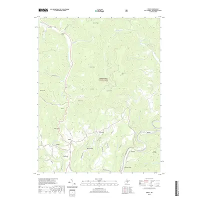
2019 Map of Edray
USGS Topo · Published 2019About this map
Marlinton serves as a focal point at the southern edge of this West Virginia landscape, where the confluence of several streams meets the winding Greenbrier River. The terrain is defined by the high ridges of the Monongahela National Forest, including Cloverlick Mtn and Moffett Knob. Transportation patterns are dictated by these elevations, with roads like Buzzard Ridge Rd following high ground while the Greenbrier River Rail-Trail traces the level river corridor through Clawson and Harter. Local history is preserved in several small settlements and family-named landmarks. Small clusters such as Edray and Warwick are situated along the valley floors, supported by water sources like McLaughlin Spring and Averill Spring. For genealogists, the placement of the Gibson Cem and Hannah Cem near Pleasant Valley provides specific locations for tracing early families in this part of Pocahontas County.
Find a feature on this map
64 named features on this map. Tap any name to fly to it.
Don’t see what you’re looking for? This feature index may not catch every label — zoom into the map to look around manually.
Map Details
Editions of this 2019 Edray Map
This is the sole edition of this map. No revisions or reprints were ever made.
Other maps of this area

1891 · Huntersville
USGS Topo · 1:125,000

1894 · Huntersville
USGS Topo · 1:125,000

1901 · Monterey
USGS Topo · 1:125,000

1922 · Cass
USGS Topo · 1:48,000

1923 · Marlinton
USGS Topo · 1:48,000

1923 · Warm Springs
USGS Topo · 1:48,000

1923 · Mingo
USGS Topo · 1:48,000

1924 · Cass
USGS Topo · 1:62,500

1925 · Mingo
USGS Topo · 1:62,500

1925 · Marlinton
USGS Topo · 1:62,500