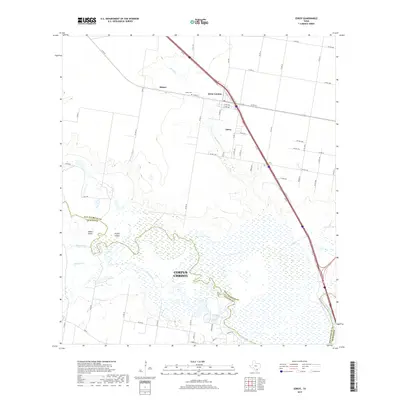
2019 Map of Edroy
USGS Topo · Published 2019About this map
The Nueces River forms the southern boundary of this coastal bend landscape, its winding channel and associated wetlands framing Odem Island and Griffin Island. The map shows a clear transition from the expansive floodplain in the south to the higher agricultural and residential areas to the north. The settlement of Edroy and the neighboring Edroy Colonia serve as local hubs, situated along the primary transportation corridor that cuts diagonally across the quadrangle. Local genealogy is supported by the location of the Edroy Cem, while the small community of Hubert remains a distinct marker on the rural road network. The drainage system is further defined by Hondo Cr and Cayamon Cr, which feed into the primary river system as it approaches the Corpus Christi city limits.
Find a feature on this map
59 named features on this map. Tap any name to fly to it.
Don’t see what you’re looking for? This feature index may not catch every label — zoom into the map to look around manually.
Map Details
Editions of this 2019 Edroy Map
This is the sole edition of this map. No revisions or reprints were ever made.
Other maps of this area

1925 · Robstown
USGS Topo · 1:62,500

1927 · Mathis
USGS Topo · 1:62,500

1950 · Corpus Christi
USGS Topo · 1:250,000

1953 · Beeville
USGS Topo · 1:250,000

1954 · Orange Grove
USGS Topo · 1:62,500

1954 · Robstown
USGS Topo · 1:62,500

1954 · Mathis
USGS Topo · 1:62,500

1954 · Sinton
USGS Topo · 1:62,500

1956 · Corpus Christi
USGS Topo · 1:250,000

1956 · Beeville
USGS Topo · 1:250,000