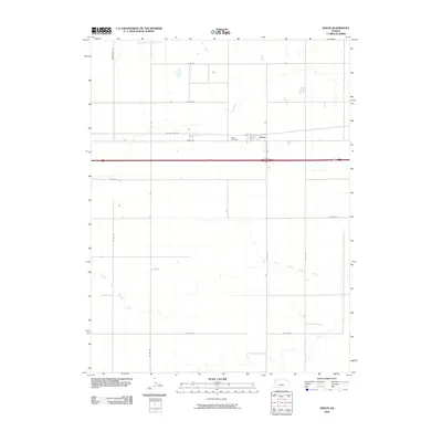
2009 Map of Edson
USGS Topo · Published 2009About this map
Edson serves as the central point of this High Plains landscape, situated just north of the busy transit corridor of I-70. The settlement is defined by its agricultural grid and proximity to traditional transportation routes, including Old US Hwy 24, which parallels the modern interstate. To the east of the town center lies the Edson Cemetery, a primary site for local genealogical research. The terrain is bisected by the intermittent drainage of the Middle Fork Sappa Creek in the north and the meandering South Fork Sappa Creek in the southern half. A network of numbered county roads, such as Co Rd 64 and Co Rd 29, provides structure to the surrounding farmland, reflecting the organized land management of Sherman County.
Find a feature on this map
18 named features on this map. Tap any name to fly to it.
Don’t see what you’re looking for? This feature index may not catch every label — zoom into the map to look around manually.
Map Details
Editions of this 2009 Edson Map
This is the sole edition of this map. No revisions or reprints were ever made.
Other maps of this area

1954 · Goodland
USGS Topo · 1:250,000

1956 · Goodland
USGS Topo · 1:250,000

1957 · Goodland
USGS Topo · 1:250,000

1959 · Harris Draw
USGS Topo · 1:62,500

1966 · Goodland NW
USGS Topo · 1:24,000

1966 · Goodland
USGS Topo · 1:24,000

1966 · Edson
USGS Topo · 1:24,000

1966 · Goodland NE
USGS Topo · 1:24,000

1966 · Brewster NW
USGS Topo · 1:24,000

1966 · Brewster
USGS Topo · 1:24,000