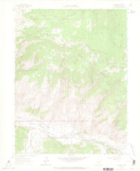
1962 Map of Edwards
USGS Topo · Published 1969About this map
The Eagle River valley serves as the primary corridor for settlement and industry in this 1960s survey of Eagle County. The Denver and Rio Grande Western railroad tracks parallel the river, connecting the small communities of Edwards and Avon. A network of irrigation infrastructure, including the Winslow Ditch and Metcalf Ditch, reflects the importance of water management for the valley floor. To the north, the terrain rises sharply into the White River National Forest, where features like Red and White Mountain and Rock Creek Park dominate the landscape.
Find a feature on this map
46 named features on this map. Tap any name to fly to it.
Don’t see what you’re looking for? This feature index may not catch every label — zoom into the map to look around manually.
Map Details
Editions of this 1962 Edwards Map
8 editions found

Other maps of this area

1933 · Mt. Powell
USGS Topo · 1:48,000

1934 · Minturn
USGS Topo · 1:62,500

1940 · Mount Powell
USGS Topo · 1:62,500

1950 · Minturn
USGS Topo · 1:62,500

1957 · Leadville
USGS Topo · 1:250,000

1959 · Leadville
USGS Topo · 1:250,000

1960 · Leadville
USGS Topo · 1:250,000

1962 · Leadville
USGS Topo · 1:250,000

1962 · Grouse Mountain
USGS Topo · 1:24,000

1962 · Fulford
USGS Topo · 1:24,000