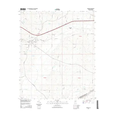
2015 Map of Edwards
USGS Topo · Published 2015About this map
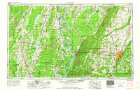
Edwards serves as the central hub of this Mississippi landscape, positioned where local roads like Vicksburg St and Montgomery ST meet. The town's layout is bordered to the north by the rolling topography leading toward Champion Hill, a significant landmark in Hinds County history. The map detail highlights the intersection of rural life and natural hydrology, with Bakers Cr winding south from the heights near Champion Hill to meet the larger drainage of Fourteenmile Cr. Local genealogists will find value in the precise locations of the Edwards Cem and the more remote Friendship Cem to the southwest. Scattered water bodies, from the small Armstrong Pond to the larger Lake Adanac, interrupt the drainage patterns of Messenger Cr and Shiloh Cr, reflecting the diverse water resources of this 2015 survey.
Find a feature on this map
69 named features on this map. Tap any name to fly to it.
Don’t see what you’re looking for? This feature index may not catch every label — zoom into the map to look around manually.
Map Details
Editions of this 2015 Edwards Map
This is the sole edition of this map. No revisions or reprints were ever made.
Other maps of this area
1903 · Jackson
USGS Topo · 1:125,000
1934 · Raymond
USGS Topo · 1:48,000
1937 · Raymond
USGS Topo · 1:62,500
1937 · Terry
USGS Topo · 1:48,000
1938 · Edwards
USGS Topo · 1:62,500
1942 · Raymond
USGS Topo · 1:62,500
1943 · Terry
USGS Topo · 1:62,500

1955 · Jackson
USGS Topo · 1:250,000

1961 · Jackson
USGS Topo · 1:250,000
1962 · Jackson
USGS Topo · 1:250,000