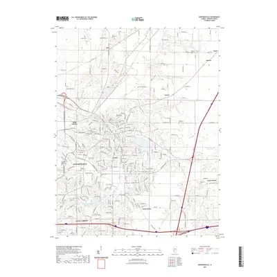
2021 Map of Edwardsville
USGS Topo · Published 2021About this map
Edwardsville and Glen Carbon anchor this modern landscape in Madison County, defined by a complex intersection of suburban development and agricultural legacy. The terrain is drained by Cahokia Creek and several smaller tributaries like Little Mooney Creek and Wendell Branch. This 2021 update shows the extensive footprint of Southern Illinois University Edwardsville and the surrounding residential subdivisions, including the Lakewood Subdivision.
Find a feature on this map
223 named features on this map. Tap any name to fly to it.
Don’t see what you’re looking for? This feature index may not catch every label — zoom into the map to look around manually.
Map Details
Editions of this 2021 Edwardsville Map
This is the sole edition of this map. No revisions or reprints were ever made.
Other maps of this area

1888 · St. Louis
USGS Topo · 1:62,500

1907 · Belleville
USGS Topo · 1:62,500

1927 · Alton
USGS Topo · 1:62,500

1927 · Edwardsville
USGS Topo · 1:62,500

1932 · Edwardsville
USGS Topo · 1:62,500

1934 · Alton
USGS Topo · 1:62,500

1935 · Monks Mound
USGS Topo · 1:24,000

1937 · Collinsville
USGS Topo · 1:24,000

1948 · Wood River
USGS Topo · 1:24,000

1949 · Saint Louis
USGS Topo · 1:250,000