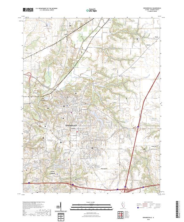
2024 Map of Edwardsville
USGS Topo · Published 2024About this map
The Madison County Courthouse stands as the central hub of Edwardsville, a community defined by its sprawling residential growth and deeply rooted local history. The town's historical landscape is notably punctuated by numerous burial grounds, including the Wolf Family Cem, Saint Boniface Catholic Cem, and Lusk Cem, which provide a clear record of early family settlements and religious foundations. Beyond the urban center, the geography transitions into a landscape carved by waterways such as Cahokia Creek and Mooney Creek, which likely shaped the early transport and settlement patterns of outlying hamlets.
Find a feature on this map
136 named features on this map. Tap any name to fly to it.
Don’t see what you’re looking for? This feature index may not catch every label — zoom into the map to look around manually.
Map Details
Editions of this 2024 Edwardsville Map
This is the sole edition of this map. No revisions or reprints were ever made.
Other maps of this area

1888 · St. Louis
USGS Topo · 1:62,500

1907 · Belleville
USGS Topo · 1:62,500

1927 · Alton
USGS Topo · 1:62,500

1927 · Edwardsville
USGS Topo · 1:62,500

1932 · Edwardsville
USGS Topo · 1:62,500

1934 · Alton
USGS Topo · 1:62,500

1935 · Monks Mound
USGS Topo · 1:24,000

1937 · Collinsville
USGS Topo · 1:24,000

1948 · Wood River
USGS Topo · 1:24,000

1949 · Saint Louis
USGS Topo · 1:250,000