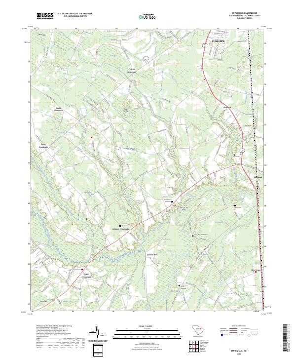
2024 Map of Effingham
USGS Topo · Published 2024About this map
The Lynches River system dominates this landscape south of Florence, defining a terrain of wetland bays and numerous crossing points. Small agricultural communities are frequently clustered at junctions, such as Johnson Crossroads, Peniel Crossroads, and Cusac Crossroads, reflecting a historical settlement pattern centered on rural road networks. Along the river, the legacy of early industry and transport is visible at Lynches Mill and the Old Saw Mill Ferry site near Elim.
Find a feature on this map
130 named features on this map. Tap any name to fly to it.
Don’t see what you’re looking for? This feature index may not catch every label — zoom into the map to look around manually.
Map Details
Editions of this 2024 Effingham Map
This is the sole edition of this map. No revisions or reprints were ever made.
Other maps of this area

1940 · Florence West
USGS Topo · 1:62,500

1940 · Florence East
USGS Topo · 1:62,500

1945 · Florence East
USGS Topo · 1:62,500

1945 · Florence West
USGS Topo · 1:62,500

1946 · Hyman
USGS Topo · 1:62,500

1946 · Lake City
USGS Topo · 1:62,500

1949 · Georgetown
USGS Topo · 1:250,000

1953 · Florence
USGS Topo · 1:250,000

1954 · Florence
USGS Topo · 1:250,000

1967 · Georgetown
USGS Topo · 1:250,000