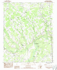
1986 Map of Effingham
USGS Topo · Published 1987About this map
Lynches River meanders through the heart of this Florence County landscape, defining the local geography with its associated swampy lowlands and seasonal bays. The area is characterized by a high concentration of spiritual and community centers, including Meadow Prong Ch and Cem, Mossy Grove Ch and Cem, and the Sand Hill Original Ch. The presence of Lynches Mill and several major crossroads like Perkins Crossroads and Johnson Crossroads suggests a long-standing agricultural and local trade network.
Find a feature on this map
41 named features on this map. Tap any name to fly to it.
Don’t see what you’re looking for? This feature index may not catch every label — zoom into the map to look around manually.
Map Details
Editions of this 1986 Effingham Map
This is the sole edition of this map. No revisions or reprints were ever made.
Other maps of this area

1940 · Florence West
USGS Topo · 1:62,500

1940 · Florence East
USGS Topo · 1:62,500

1945 · Florence East
USGS Topo · 1:62,500

1945 · Florence West
USGS Topo · 1:62,500

1946 · Hyman
USGS Topo · 1:62,500

1946 · Lake City
USGS Topo · 1:62,500

1949 · Georgetown
USGS Topo · 1:250,000

1953 · Florence
USGS Topo · 1:250,000

1954 · Florence
USGS Topo · 1:250,000

1967 · Georgetown
USGS Topo · 1:250,000