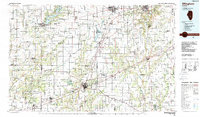
1986 Map of Effingham
USGS Topo · Published 1988About this map
Lake Shelbyville dominates the northwestern portion of this mid-1980s landscape, where the Kaskaskia River was transformed into a major recreational and water management reservoir. The map reveals the intricate transport network of central Illinois during a period of industrial transition, anchored by the crossroads of Interstate 57 and Interstate 70 at Effingham. This intersection serves as a modern hub for older rail lines like the Illinois Central Gulf Railroad and the Norfolk and Western Railway.
Find a feature on this map
166 named features on this map. Tap any name to fly to it.
Don’t see what you’re looking for? This feature index may not catch every label — zoom into the map to look around manually.
Map Details
Editions of this 1986 Effingham Map
2 editions found
Other maps of this area

1910 · Hardinville
USGS Topo · 1:62,500

1933 · Toledo
USGS Topo · 1:62,500

1934 · Mattoon
USGS Topo · 1:62,500

1935 · Arcola
USGS Topo · 1:48,000

1935 · Sullivan
USGS Topo · 1:48,000

1936 · Oakland
USGS Topo · 1:48,000

1936 · Casey
USGS Topo · 1:48,000

1937 · Mattoon
USGS Topo · 1:62,500

1938 · Toledo
USGS Topo · 1:62,500

1940 · Sullivan
USGS Topo · 1:62,500