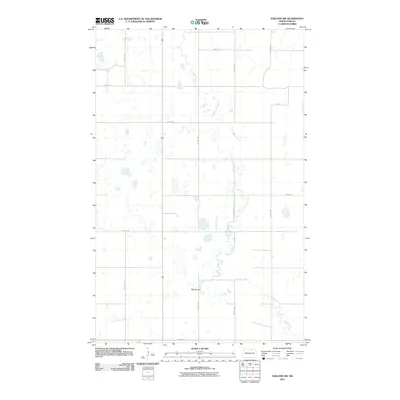
2011 Map of Egeland SW
USGS Topo · Published 2011About this map
Big Coulee and the meandering Mauvais Coulee dominate this prairie landscape in Towner County, illustrating a complex network of glacial drainage typical of the North Dakota pothole region. The terrain is defined by an intricate system of small wetlands and ephemeral water bodies that weave between a rigid section-line road grid. Human presence is marked primarily by this agricultural framework, with thoroughfares such as 66th Ave NE and 83rd St NE providing access across the hydrologically diverse plains. The presence of 81st Dr indicates localized residential or service access within this expansive drainage basin, where the water flows dictate the use of the land between the rectilinear boundaries of the Great Plains survey system.
Find a feature on this map
13 named features on this map. Tap any name to fly to it.
Don’t see what you’re looking for? This feature index may not catch every label — zoom into the map to look around manually.
Map Details
Editions of this 2011 Egeland SW Map
This is the sole edition of this map. No revisions or reprints were ever made.
Other maps of this area

1953 · Devils Lake
USGS Topo · 1:250,000

1956 · Devils Lake
USGS Topo · 1:250,000

1957 · Cando
USGS Topo · 1:24,000

1957 · Cando NE
USGS Topo · 1:24,000

1962 · Egeland SE
USGS Topo · 1:24,000

1962 · Egeland SW
USGS Topo · 1:24,000

1962 · Egeland
USGS Topo · 1:24,000

1962 · Snyder Lake
USGS Topo · 1:24,000

1971 · Considine
USGS Topo · 1:24,000

1971 · Leeds NE
USGS Topo · 1:24,000