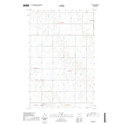
2020 Map of Egeland
USGS Topo · Published 2020About this map
Egeland anchors the southern edge of this prairie landscape in Towner County, situated at the convergence of a grid-like network of rural section roads. The terrain is defined by a dense concentration of wetlands and small water bodies that characterize this portion of the North Dakota pothole region. Surveyed in 2020, the map illustrates the precise layout of the town's residential core, including 1st Ave and 4th Ave, surrounded by expansive agricultural tracts. The township boundaries, such as t161n r65w and t160n r65w, reveal the systematic division of the land that has guided local property lines and farming practices for generations. This survey provides a clear view of the modern infrastructure and natural drainage patterns near the northern border of the state.
Find a feature on this map
26 named features on this map. Tap any name to fly to it.
Don’t see what you’re looking for? This feature index may not catch every label — zoom into the map to look around manually.
Map Details
Editions of this 2020 Egeland Map
This is the sole edition of this map. No revisions or reprints were ever made.
Other maps of this area

1953 · Devils Lake
USGS Topo · 1:250,000

1956 · Devils Lake
USGS Topo · 1:250,000

1962 · Egeland SE
USGS Topo · 1:24,000

1962 · Egeland SW
USGS Topo · 1:24,000

1962 · Egeland
USGS Topo · 1:24,000

1962 · Snyder Lake
USGS Topo · 1:24,000

1970 · Calvin
USGS Topo · 1:24,000

1970 · Rock Lake
USGS Topo · 1:24,000

1970 · Rock Lake SE
USGS Topo · 1:24,000

1971 · Calio
USGS Topo · 1:24,000