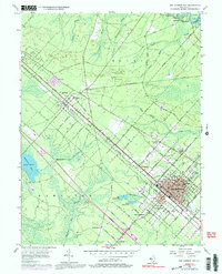
1956 Map of Egg Harbor City
USGS Topo · Published 1991About this map
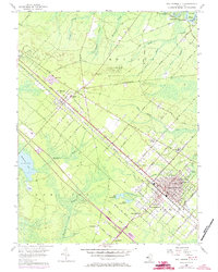
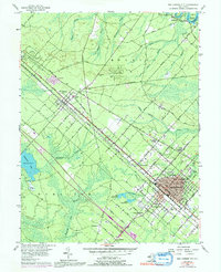
Egg Harbor City dominates the southeastern quadrant of this map, its rigid grid of streets named for international cities like Antwerp Avenue and Bremen Avenue contrasting with the wandering branches of the Mullica River to the north. The area's mid-century transportation network is defined by the Pennsylvania Reading Seashore Lines and the White Horse Pike, which cut diagonally through the pine forests. Smaller outlying settlements such as Elwood, Magnolia, and Devonshire dot the rail corridor, while the southern landscape near Carmantown and Laureldale shows a transition toward more open terrain.
Find a feature on this map
63 named features on this map. Tap any name to fly to it.
Don’t see what you’re looking for? This feature index may not catch every label — zoom into the map to look around manually.
Map Details
Editions of this 1956 Egg Harbor City Map
6 editions found
Other maps of this area

1890 · Great Egg Harbor
USGS Topo · 1:62,500

1890 · Hammonton
USGS Topo · 1:62,500

1890 · Tuckahoe
USGS Topo · 1:62,500

1890 · Mullica
USGS Topo · 1:62,500

1893 · Great Egg Harbor
USGS Topo · 1:62,500

1893 · Tuckahoe
USGS Topo · 1:62,500

1894 · Hammonton
USGS Topo · 1:62,500

1894 · Mullica
USGS Topo · 1:62,500

1898 · Mullica
USGS Topo · 1:62,500

1898 · Hammonton
USGS Topo · 1:62,500
Featured Places
- Galloway Township, NJ
- Hamilton Township, NJ
- Mullica Township, NJ
- Egg Harbor City, NJ
- Washington Township, NJ