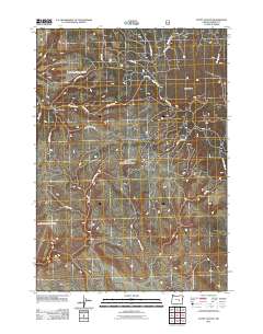
2011 Map of Egypt Canyon
USGS Topo · Published 2011About this map
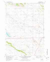
Egypt Canyon and Egypt Creek define the western reaches of this high-desert landscape in Harney County, Oregon. This 2011 survey illustrates a territory primarily structured by forest service access and historical range routes, where water sources like Badger Spring and Stinger Creek served as essential landmarks for navigation and land management. The terrain is marked by prominent elevations such as Green Butte, which overlooks a dense network of numbered and named secondary roads. Named routes like Gus Well Rd, Donnelly Rd, and Beaver Slide Rd suggest a history of ranching, timber access, or recreational use within the national forest system. The presence of Lost Spring Rd and Curly Canyon Rd points to the specific local nomenclature used by those who worked and traversed this part of the Oregon backcountry in the early 21st century.
Find a feature on this map
18 named features on this map. Tap any name to fly to it.
Don’t see what you’re looking for? This feature index may not catch every label — zoom into the map to look around manually.
Map Details
Editions of this 2011 Egypt Canyon Map
This is the sole edition of this map. No revisions or reprints were ever made.
Other maps of this area

1955 · Burns
USGS Topo · 1:250,000

1958 · Burns
USGS Topo · 1:250,000

1959 · Burns
USGS Topo · 1:250,000

1959 · Sawtooth Creek
USGS Topo · 1:62,500

1961 · Delintment Lake
USGS Topo · 1:62,500

1981 · Sage Hen Hill
USGS Topo · 1:24,000
1981 · Egypt Canyon
USGS Topo · 1:24,000
1981 · Oakerman Lakes
USGS Topo · 1:24,000
1981 · Holmes Canyon
USGS Topo · 1:24,000
1981 · Riley
USGS Topo · 1:24,000