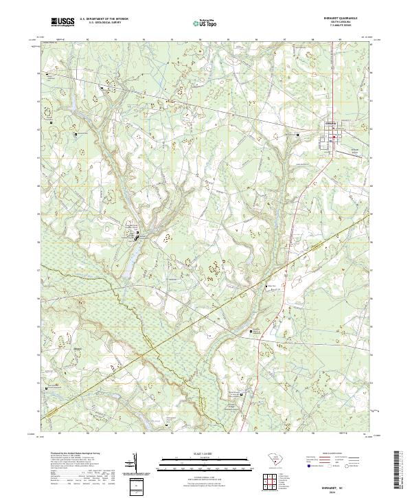
2024 Map of Ehrhardt
USGS Topo · Published 2024About this map
Ehrhardt serves as the primary hub in this Lowcountry landscape, situated where the Salkehatchie River and its numerous tributaries like Threemile Branch and Savannah Creek define the local topography. The map reveals a dense concentration of family and community history, particularly through its cemeteries and churchyards. Distinctive sites such as the Rivers Bridges Confederate Cem and the Burial Ground of John and Mary Broxton point to deep genealogical roots in the region.
Find a feature on this map
101 named features on this map. Tap any name to fly to it.
Don’t see what you’re looking for? This feature index may not catch every label — zoom into the map to look around manually.
Map Details
Editions of this 2024 Ehrhardt Map
This is the sole edition of this map. No revisions or reprints were ever made.
Other maps of this area

1918 · Varnville
USGS Topo · 1:62,500

1919 · Olar
USGS Topo · 1:62,500

1919 · Cummings
USGS Topo · 1:62,500

1919 · Lodge
USGS Topo · 1:62,500

1920 · Lodge
USGS Topo · 1:48,000

1921 · Lodge
USGS Topo · 1:62,500

1943 · Olar
USGS Topo · 1:62,500

1943 · Lodge
USGS Topo · 1:62,500

1943 · Orangeburg
USGS Topo · 1:125,000

1943 · Cummings
USGS Topo · 1:62,500