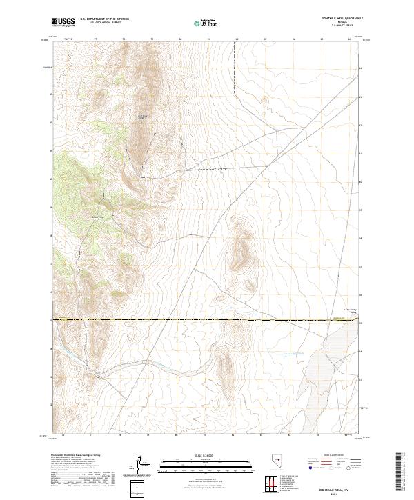
2021 Map of Eightmile Well
USGS Topo · Published 2021About this map
The Fish Creek Range and the high elevations of Bisoni Ridge dominate this interior Nevada landscape, where the high desert terrain transitions into the Little Smoky Valley. This modern survey illustrates the rugged physical geography that defines the border between Eureka Co and Nye Co. The most prominent hydrologic feature is Cockalorum Wash, which winds across the southern reaches of the quadrangle. The map is primarily characterized by the township and range divisions, such as t16n r52e and t15n r53e, showing a region defined more by its massive geological features than by human settlement. Researchers can observe how water drainage patterns from the ridges feed into the valley floors, a critical factor for land use in this arid environment.
Find a feature on this map
9 named features on this map. Tap any name to fly to it.
Don’t see what you’re looking for? This feature index may not catch every label — zoom into the map to look around manually.
Map Details
Editions of this 2021 Eightmile Well Map
This is the sole edition of this map. No revisions or reprints were ever made.
Other maps of this area

1926 · Roberts Mountains
USGS Topo · 1:250,000

1929 · Roberts Mountains
USGS Topo · 1:250,000

1953 · Pinto Summit
USGS Topo · 1:62,500

1955 · Millett
USGS Topo · 1:250,000

1956 · Bellevue Peak
USGS Topo · 1:62,500

1956 · Cockalorum Wash
USGS Topo · 1:62,500

1956 · Ely
USGS Topo · 1:250,000

1959 · Ely
USGS Topo · 1:250,000

1959 · Millett
USGS Topo · 1:250,000

1963 · Ely
USGS Topo · 1:250,000