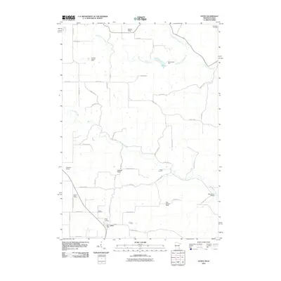
2010 Map of Eitzen
USGS Topo · Published 2010About this map
Eitzen sits at the southern edge of this Minnesota landscape, positioned just above the state line in a region defined by high ridges and carved drainage basins. The settlement serves as a local hub, anchored by the Eitzen Post Office and Saint Lukes Cemetery. To the northwest, the historic area of Portland Prairie is evidenced by the Portland Prairie Cemetery, marking the community's early agricultural roots.
Find a feature on this map
54 named features on this map. Tap any name to fly to it.
Don’t see what you’re looking for? This feature index may not catch every label — zoom into the map to look around manually.
Map Details
Editions of this 2010 Eitzen Map
This is the sole edition of this map. No revisions or reprints were ever made.
Other maps of this area

1903 · Waukon
USGS Topo · 1:125,000

1906 · Decorah
USGS Topo · 1:125,000

1956 · Brownsville
USGS Topo · 1:62,500

1958 · La Crosse
USGS Topo · 1:250,000

1961 · La Crosse
USGS Topo · 1:250,000

1965 · La Crosse
USGS Topo · 1:250,000

1965 · Wilmington
USGS Topo · 1:24,000

1965 · Sheldon
USGS Topo · 1:24,000
1968 · New Albin
USGS Topo · 1:24,000
1968 · Waukon NW
USGS Topo · 1:24,000