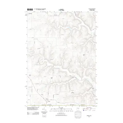
2013 Map of Eitzen
USGS Topo · Published 2013About this map
Eitzen sits at the southern edge of this Houston County landscape, where the Minnesota-Iowa border defines the lower boundary of a deeply dissected terrain. The area is characterized by prominent high ground such as Cabbage Ridge, Dog Square Ridge, and Jefferson Ridge, which separate the various drainages of Winnebago Cr and Crooked Cr. This agricultural and bluffland region preserves several legacy sites for genealogists, including the Grove Prairie Cem, Steele Cem, and the Carsten Cem near the historic Portland Prairie settlement. Roads like MN-76 and Co HWY-23 wind through the topography, connecting scattered farmsteads and rural landmarks like the Saint Lukes Cem and the local Post Office in Eitzen. The map details the complex physical geography of New Yorker Hollow and the winding course of the S Fork Dr as they navigate the ridges of the Driftless Area.
Find a feature on this map
58 named features on this map. Tap any name to fly to it.
Don’t see what you’re looking for? This feature index may not catch every label — zoom into the map to look around manually.
Map Details
Editions of this 2013 Eitzen Map
This is the sole edition of this map. No revisions or reprints were ever made.
Other maps of this area

1903 · Waukon
USGS Topo · 1:125,000

1906 · Decorah
USGS Topo · 1:125,000

1956 · Brownsville
USGS Topo · 1:62,500

1958 · La Crosse
USGS Topo · 1:250,000

1961 · La Crosse
USGS Topo · 1:250,000

1965 · La Crosse
USGS Topo · 1:250,000

1965 · Wilmington
USGS Topo · 1:24,000

1965 · Sheldon
USGS Topo · 1:24,000
1968 · New Albin
USGS Topo · 1:24,000
1968 · Waukon NW
USGS Topo · 1:24,000