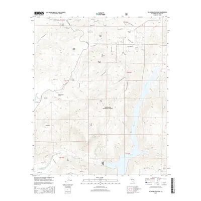
2015 Map of El Cajon Mountain
USGS Topo · Published 2015About this map
San Vicente Valley and the northern reaches of the Cleveland National Forest dominate this landscape, showcasing the dramatic elevation changes east of San Diego. The prominence of El Cajon Mtn stands as a central landmark above the San Diego River watershed. Water management and storage are central features of the geography, with the San Diego River feeding into El Capitan Lake in the southeast corner. The map traces a network of remote access routes such as the El Cajon Mountain Truck Trl and Capitan Truck Trl, which navigate the steep terrain between Silverdome and Rock Mtn. The Barona area and Barona Valley reflect the rural character of the region, while the Cape Horn Tunnel indicates the engineering required to traverse these foothills.
Find a feature on this map
68 named features on this map. Tap any name to fly to it.
Don’t see what you’re looking for? This feature index may not catch every label — zoom into the map to look around manually.
Map Details
Editions of this 2015 El Cajon Mountain Map
This is the sole edition of this map. No revisions or reprints were ever made.
Other maps of this area

1893 · El Cajon
USGS Topo · 1:62,500

1901 · Elcajon
USGS Topo · 1:62,500

1903 · Cuyamaca
USGS Topo · 1:125,000

1903 · Elcajon
USGS Topo · 1:62,500

1903 · Ramona
USGS Topo · 1:125,000

1904 · Southern California Sheet No. 2
USGS Topo · 1:250,000

1939 · El Cajon
USGS Topo · 1:62,500

1939 · Santa Ysabel
USGS Topo · 1:62,500

1942 · El Cajon
USGS Topo · 1:62,500

1942 · Ramona
USGS Topo · 1:62,500