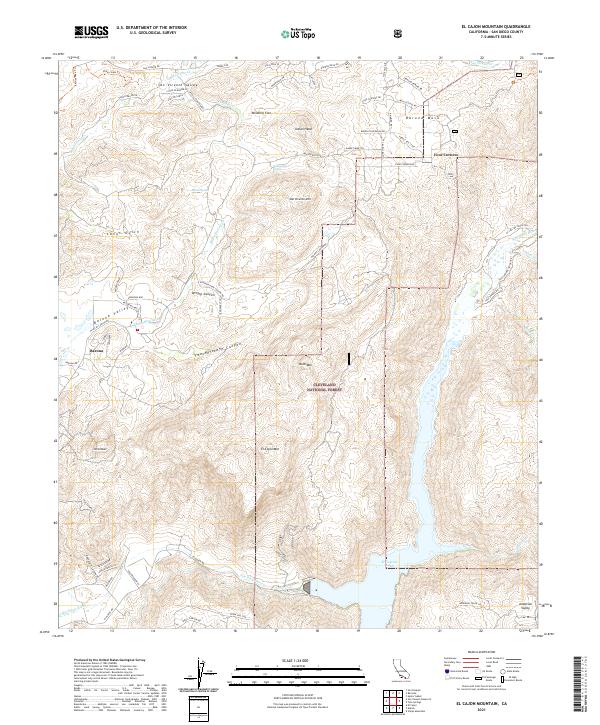
2021 Map of El Cajon Mountain
USGS Topo · Published 2021About this map
Cleveland National Forest dominates the rugged landscape of this San Diego County quadrangle, where the steep peaks of El Cajon Mtn and the Silverdome overlook the massive reservoir of El Capitan Lake. The 2021 survey shows a complex interface of protected wilderness and developed valleys. Along the western edge, the settlement of Barona sits within the Barona Valley, connected to the high plateau of Barona Mesa by a network of local roads and trails like the Garnet Mine Trl.
Find a feature on this map
77 named features on this map. Tap any name to fly to it.
Don’t see what you’re looking for? This feature index may not catch every label — zoom into the map to look around manually.
Map Details
Editions of this 2021 El Cajon Mountain Map
This is the sole edition of this map. No revisions or reprints were ever made.
Other maps of this area

1893 · El Cajon
USGS Topo · 1:62,500

1901 · Elcajon
USGS Topo · 1:62,500

1903 · Cuyamaca
USGS Topo · 1:125,000

1903 · Elcajon
USGS Topo · 1:62,500

1903 · Ramona
USGS Topo · 1:125,000

1904 · Southern California Sheet No. 2
USGS Topo · 1:250,000

1939 · El Cajon
USGS Topo · 1:62,500

1939 · Santa Ysabel
USGS Topo · 1:62,500

1942 · El Cajon
USGS Topo · 1:62,500

1942 · Ramona
USGS Topo · 1:62,500