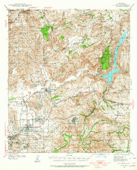
1939 Map of El Cajon
USGS Topo · Published 1964About this map
The San Diego River valley and its surrounding foothills define this late 1930s landscape, illustrating the transition from agricultural valley floors to the high granite peaks of the Cleveland National Forest. The map documents a diverse local economy through labels like the Edgemoor County Farm, the Daly Mine, and a local Quarry. Transportation networks are dominated by the San Diego and Arizona Eastern railroad and the convergence of routes 67 and 80 at El Cajon.
Find a feature on this map
77 named features on this map. Tap any name to fly to it.
Don’t see what you’re looking for? This feature index may not catch every label — zoom into the map to look around manually.
Map Details
Editions of this 1939 El Cajon Map
2 editions found

Other maps of this area

1893 · El Cajon
USGS Topo · 1:62,500

1893 · Escondido
USGS Topo · 1:62,500

1901 · Elcajon
USGS Topo · 1:62,500

1901 · Escondido
USGS Topo · 1:62,500

1901 · San Luis Rey
USGS Topo · 1:125,000

1903 · Cuyamaca
USGS Topo · 1:125,000

1903 · La Jolla
USGS Topo · 1:62,500

1903 · Elcajon
USGS Topo · 1:62,500

1903 · Ramona
USGS Topo · 1:125,000

1904 · San Diego
USGS Topo · 1:62,500