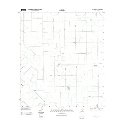
2013 Map of El Campo SE
USGS Topo · Published 2013About this map
Hillje Oil Field and the Radio Astronomical Observatory sit among the structured agricultural grid of Wharton County in this 2013 survey. The landscape is defined by its drainage and irrigation networks, where the Plainview Outflow Ditch manages water movement toward a series of natural waterways, including Little Carancahua Creek and East Carancahua Creek. This coastal prairie region exhibits a high degree of land management, with an extensive network of county roads such as Co RD-318 and Co RD-320 providing access to deep-field oil operations and rural aviation facilities like Smith Aviation Inc Airport. Local family-named routes and small tributaries like Moccasin Cr and Stage Stand Cr offer precise geographic anchors for genealogists and researchers tracking land use in the plains south of El Campo.
Find a feature on this map
43 named features on this map. Tap any name to fly to it.
Don’t see what you’re looking for? This feature index may not catch every label — zoom into the map to look around manually.
Map Details
Editions of this 2013 El Campo SE Map
This is the sole edition of this map. No revisions or reprints were ever made.
Other maps of this area
1951 · Danevang
USGS Topo · 1:24,000
1952 · Francitas NW
USGS Topo · 1:24,000
1952 · Francitas NE
USGS Topo · 1:24,000
1952 · Midfield
USGS Topo · 1:24,000
1952 · Pierce
USGS Topo · 1:24,000
1953 · Beeville
USGS Topo · 1:250,000
1953 · Seguin
USGS Topo · 1:250,000
1956 · Beeville
USGS Topo · 1:250,000
1958 · Seguin
USGS Topo · 1:250,000
1960 · Beeville
USGS Topo · 1:250,000