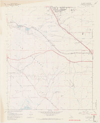
1967 Map of El Casco
USGS Topo · Published 1968About this map
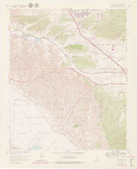
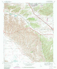
The Badlands dominate the central portion of this 1967 survey, where the complex topography of the San Jacinto Valley meets the lower reaches of San Timoteo Canyon. Along the northern edge, the growing residential corridors of Yucaipa and Calimesa contrast with the rural character of the Southern Pacific rail line as it follows San Timoteo Creek through the pass. Historically significant sites like Eden Hot Springs and the small settlement of Nicklin are clearly marked, alongside the Forest Lawn Memorial Gardens and the family-named Mt Eden. This map documents a transitional period in Riverside County when agriculture and early suburban developments shared space with rugged terrain features like the Duck Ponds and the winding Jackrabbit Trail.
Find a feature on this map
29 named features on this map. Tap any name to fly to it.
Don’t see what you’re looking for? This feature index may not catch every label — zoom into the map to look around manually.
Map Details
Editions of this 1967 El Casco Map
6 editions found
Other maps of this area

1899 · Redlands
USGS Topo · 1:62,500

1901 · Southern California Sheet No. 1
USGS Topo · 1:250,000

1901 · San Jacinto
USGS Topo · 1:125,000

1901 · Redlands
USGS Topo · 1:62,500

1901 · Elsinore
USGS Topo · 1:125,000

1902 · San Gorgonio
USGS Topo · 1:125,000

1904 · Southern California Sheet No. 1
USGS Topo · 1:250,000

1942 · Banning
USGS Topo · 1:62,500

1942 · Perris
USGS Topo · 1:62,500

1943 · Perris
USGS Topo · 1:62,500