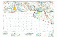
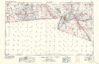
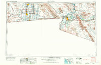
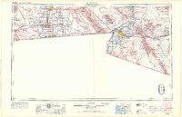
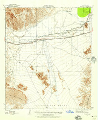
1958 Map of El Centro
USGS Topo · Published 1978About this map
The Imperial Valley dominates this 1950s perspective of the California-Arizona borderlands, showing a complex hydraulic landscape where the All American Canal and Coachella Canal transformed the desert into a productive agricultural hub. Regional centers like El Centro, Brawley, and Calexico are depicted alongside the intricate web of laterals and canals, such as the Wistaria Lateral, that define the valley's settlement patterns. This revised edition captures the area just before significant suburban expansion, while the presence of the Naval Air Facility and Imperial County Airport highlights the region's mid-century strategic and transportation importance.
Find a feature on this map
89 named features on this map. Tap any name to fly to it.
Don’t see what you’re looking for? This feature index may not catch every label — zoom into the map to look around manually.
Map Details
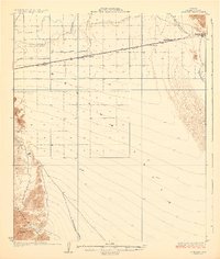
Editions of this 1958 El Centro Map
4 editions found
Other maps of this area

1903 · Yuma
USGS Topo · 1:125,000

1905 · Yuma
USGS Topo · 1:125,000

1907 · Holtville
USGS Topo · 1:125,000

1915 · El Centro
USGS Topo · 1:125,000

1926 · Fortuna
USGS Topo · 1:62,500
1926 · Wellton
USGS Topo · 1:62,500

1926 · Mohawk
USGS Topo · 1:62,500
1928 · Mohawk
USGS Topo · 1:62,500

1928 · Norton
USGS Topo · 1:62,500
1929 · Fortuna
USGS Topo · 1:62,500