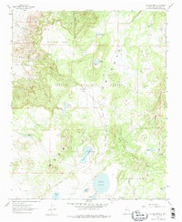
1961 Map of El Dado Mesa
USGS Topo · Published 1975About this map
El Dado Mesa dominates the northern landscape of this McKinley County quadrangle, situated within the eastern reaches of the Cibola National Forest. The 1961 field check reveals a high-desert environment characterized by numerous seasonal water sources and natural catchments, including Laguna Grande, Laguna de Alejandro, and Laguna del Cerro. These water features, alongside springs like Ojo del Dado and Ojo de las Yeguas, indicate the critical role of moisture in managing this highland terrain for grazing. The map also delineates a significant Grant Boundary that bisects the southern half of the sheet, separating the forested national lands from the expansive Cebolleta Mesa and Mesa de los Canoneros. Topographical transitions are sharp, moving from the level surfaces of the mesas into deeply incised drainages such as Cañon del Dado and the Rincon del Dado.
Find a feature on this map
27 named features on this map. Tap any name to fly to it.
Don’t see what you’re looking for? This feature index may not catch every label — zoom into the map to look around manually.
Map Details
Editions of this 1961 El Dado Mesa Map
2 editions found
Other maps of this area

1883 · Mt. Taylor
USGS Topo · 1:250,000

1886 · Mt. Taylor
USGS Topo · 1:250,000

1892 · Mt. Taylor
USGS Topo · 1:250,000

1899 · Mt. Taylor
USGS Topo · 1:250,000

1958 · Albuquerque
USGS Topo · 1:250,000

1961 · Marquez
USGS Topo · 1:24,000

1961 · El Dado
USGS Topo · 1:24,000

1961 · Cerro Parido
USGS Topo · 1:24,000

1961 · El Dado Mesa
USGS Topo · 1:24,000
1961 · Laguna Seca
USGS Topo · 1:24,000