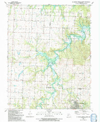
1991 Map of El Dorado Springs North
USGS Topo · Published 1991About this map
Schell-Osage State Wildlife Area dominates the northern landscape of this Missouri quadrangle, centering on the waters of Atkinson Lake and the complex drainage of Fowler Branch. The terrain transitions from these managed conservation lands toward the agricultural and residential outskirts of El Dorado Springs in the south. The map documents a rural network of small settlements and family landmarks, including Portia and Bacon, which reflect the area's mid-century community structure.
Find a feature on this map
32 named features on this map. Tap any name to fly to it.
Don’t see what you’re looking for? This feature index may not catch every label — zoom into the map to look around manually.
Map Details
Editions of this 1991 El Dorado Springs North Map
This is the sole edition of this map. No revisions or reprints were ever made.
Other maps of this area

1886 · Nevada
USGS Topo · 1:125,000

1886 · Stockton
USGS Topo · 1:125,000

1887 · Clinton
USGS Topo · 1:125,000

1887 · Butler
USGS Topo · 1:125,000

1894 · Butler
USGS Topo · 1:125,000

1894 · Nevada
USGS Topo · 1:125,000

1894 · Clinton
USGS Topo · 1:125,000

1934 · Papinsville
USGS Topo · 1:24,000

1934 · Rockville
USGS Topo · 1:24,000

1937 · Tiffin
USGS Topo · 1:31,680