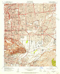
1953 Map of El Monte
USGS Topo · Published 1955About this map
The San Gabriel Mission anchors this mid-century portrait of a rapidly expanding San Gabriel Valley. Established residential grids in Alhambra and San Marino contrast with the emerging suburban developments of South San Gabriel and Temple City. The landscape is a mix of civic institutions like the Los Angeles Orphanage and the Pasadena-Rosemead Airport, which served local aviation before the full onset of the freeway era. Significant industrial activity is concentrated in the south, where Oil Wells pepper the hills near Montebello and Pico.
Find a feature on this map
117 named features on this map. Tap any name to fly to it.
Don’t see what you’re looking for? This feature index may not catch every label — zoom into the map to look around manually.
Map Details
Editions of this 1953 El Monte Map
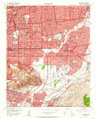
2 editions found
Other maps of this area

1894 · Los Angeles
USGS Topo · 1:62,500

1894 · Pomona
USGS Topo · 1:62,500

1896 · Pasadena
USGS Topo · 1:62,500

1896 · Anaheim
USGS Topo · 1:62,500

1896 · Downey
USGS Topo · 1:62,500

1897 · Pomona
USGS Topo · 1:62,500

1898 · Pomona
USGS Topo · 1:62,500

1898 · Anaheim
USGS Topo · 1:62,500

1899 · Downey
USGS Topo · 1:62,500

1900 · Pasadena
USGS Topo · 1:62,500