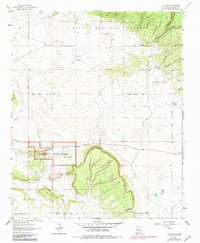
1963 Map of El Morro
USGS Topo · Published 1981About this map
Inscription Rock serves as the focal point of this New Mexico landscape, marking a site where travelers left their names in the stone for centuries. The boundary of El Morro National Monument protects this history, including a nearby Campground and the El Morro Lookout perched above the mesa. To the south, the terrain is dominated by Obe Worthen Mesa and the passage at Charlie Barns Gap, while the northern portion is held within the Cibola National Forest.
Find a feature on this map
23 named features on this map. Tap any name to fly to it.
Don’t see what you’re looking for? This feature index may not catch every label — zoom into the map to look around manually.
Map Details
Editions of this 1963 El Morro Map
3 editions found
Other maps of this area

1886 · Wingate
USGS Topo · 1:250,000

1892 · Wingate
USGS Topo · 1:250,000

1952 · Valle Largo
USGS Topo · 1:24,000

1952 · Post Office Flat
USGS Topo · 1:24,000

1954 · Saint Johns
USGS Topo · 1:250,000

1954 · Gallup
USGS Topo · 1:250,000

1957 · Saint Johns
USGS Topo · 1:250,000

1958 · Gallup
USGS Topo · 1:250,000

1958 · Saint Johns
USGS Topo · 1:250,000

1959 · Gallup
USGS Topo · 1:250,000
Featured Places
- Eastern Navajo Agency, NM
- Sand Corner, Eastern Navajo Agency
- Tinaja, Eastern Navajo Agency
- El Morro, Eastern Navajo Agency
- El Morro, Eastern Navajo Agency