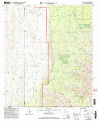
2001 Map of El Paso Gap
USGS Topo · Published 2003About this map
Lincoln National Forest and Guadalupe Mountains National Park converge at The Rim, a dramatic escarpment that defines the geography of this borderland. Near the intersection of New Mexico and Texas, the settlement of El Paso Gap Ch and nearby Cem reflect the sparse, high-desert ranching life that has long occupied these canyons. Water is the critical resource here, evidenced by numerous named sources like Devils Den Spring, Hog Spring, and Black River Spring, along with the industrial Black River Mine. The landscape is a network of ridges and drainages, from Upper Dog Canyon to the massive Big Canyon, which is fed by North Fork Big Canyon and Middle Fork Big Canyon. Long-standing cattle operations are marked by Hughes Ranch and McCollum Ranch, indicating the persistent human footprint in this protected wilderness area.
Find a feature on this map
57 named features on this map. Tap any name to fly to it.
Don’t see what you’re looking for? This feature index may not catch every label — zoom into the map to look around manually.
Map Details
Editions of this 2001 El Paso Gap Map
This is the sole edition of this map. No revisions or reprints were ever made.
Other maps of this area

1933 · Guadalupe Peak
USGS Topo · 1:48,000

1935 · El Paso Gap
USGS Topo · 1:62,500

1936 · El Paso Gap
USGS Topo · 1:48,000

1940 · El Paso Gap
USGS Topo · 1:62,500

1940 · Guadalupe Peak
USGS Topo · 1:62,500

1940 · Carlsbad Caverns West
USGS Topo · 1:62,500

1943 · Carlsbad Caverns West
USGS Topo · 1:62,500

1954 · Carlsbad
USGS Topo · 1:250,000

1954 · Van Horn
USGS Topo · 1:250,000

1958 · Van Horn
USGS Topo · 1:250,000