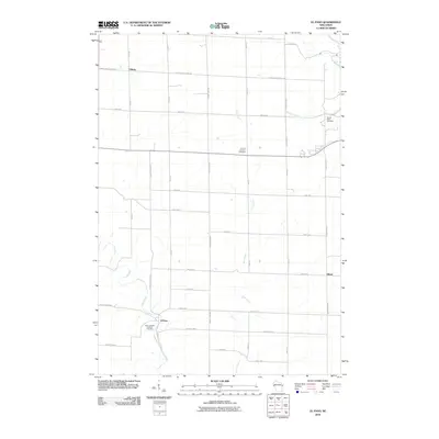
2010 Map of El Paso
USGS Topo · Published 2010About this map
The Rush River and Cave Creek define the agricultural valleys of Pierce County in this 2010 survey of the area near El Paso. The landscape is a network of township roads and county highways, supporting small rural settlements such as Viking in the northwest and Olivet to the east. Local family and congregational history is well-preserved through several established grounds, including the Saint Josephs Catholic Cemetery near the river bend and the Sacred Heart Cemetery in the northeast. The map illustrates a contemporary rural Wisconsin community where life follows the drainage patterns of the Eau Galle River and its tributaries like Mines Creek and Burkhart Creek. This detailed layout provides researchers with a clear view of land divisions and property access points as they existed in the early 21st century.
Find a feature on this map
29 named features on this map. Tap any name to fly to it.
Don’t see what you’re looking for? This feature index may not catch every label — zoom into the map to look around manually.
Map Details
Editions of this 2010 El Paso Map
This is the sole edition of this map. No revisions or reprints were ever made.
Other maps of this area

1935 · Arkansaw
USGS Topo · 1:48,000

1940 · Maiden Rock
USGS Topo · 1:62,500

1941 · Arkansaw
USGS Topo · 1:62,500

1942 · Arkansaw
USGS Topo · 1:62,500

1946 · Knapp
USGS Topo · 1:62,500

1949 · Knapp
USGS Topo · 1:62,500

1949 · Baldwin
USGS Topo · 1:62,500

1950 · Maiden Rock
USGS Topo · 1:62,500

1953 · Saint Paul
USGS Topo · 1:250,000

1959 · Saint Paul
USGS Topo · 1:250,000