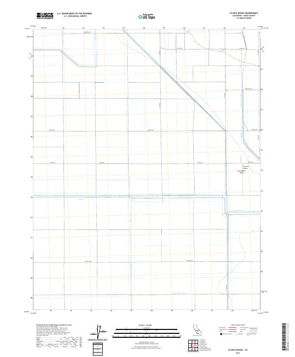
2021 Map of El Rico Ranch
USGS Topo · Published 2021About this map
Agricultural water management and vast irrigation systems define this section of the San Joaquin Valley in Kings County. The landscape is dominated by an engineered network of waterways, most notably the Tulare Lake Canal and the El-Rico-Main-Canal, which reflect the region's intensive land use and reliance on water diversion. The Tule River traverses the terrain, flanked by secondary infrastructure like the Gates-Jones Canal and Helm-Lewis Ditch. This grid-based layout illustrates the systematic division of the Central Valley into large-scale ranching and farming tracts. The map reveals the precise spatial organization of rural infrastructure, from the intersecting flow of the Middle Branch Cross Creek to the named avenues such as Pueblo Ave and Redding Ave that segment the plains.
Find a feature on this map
22 named features on this map. Tap any name to fly to it.
Don’t see what you’re looking for? This feature index may not catch every label — zoom into the map to look around manually.
Map Details
Editions of this 2021 El Rico Ranch Map
This is the sole edition of this map. No revisions or reprints were ever made.
Other maps of this area

1914 · Lost Hills
USGS Topo · 1:125,000

1928 · Waukena
USGS Topo · 1:31,680

1928 · Corcoran
USGS Topo · 1:31,680

1929 · Guernsey
USGS Topo · 1:31,680

1929 · Stratford
USGS Topo · 1:31,680

1929 · West Alpaugh
USGS Topo · 1:31,680

1931 · Harvester
USGS Topo · 1:31,680

1932 · El Rico Ranch
USGS Topo · 1:31,680

1932 · Dudley Ridge
USGS Topo · 1:31,680

1933 · Chatom Ranch
USGS Topo · 1:31,680