
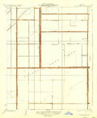
1932 Map of El Rico Ranch
USGS Topo · Published 1932About this map
Agricultural development and massive hydraulic engineering define this Central Valley landscape during the early 1930s. The region is heavily managed through an extensive network of artificial waterways and flood control structures, including the Lovelace Levee, the South Levee, and the El Rico Levee. These structures redirect the natural flow of the Tule River and Cross Creek to support large-scale landholdings. Industrialized farming operations like the Progressive Development Co and the namesake El Rico Ranch dominate the map, alongside family-named tracts such as Peterson Ranch and Johnson Ranch. The grid-like precision of 10th Avenue and Pueblo Avenue contrasts with the winding paths of the West Branch and Middle Branch, illustrating the transition from natural riparian systems to a highly engineered irrigation district served by the Dallas Canal and Guiberson Canal.
Find a feature on this map
26 named features on this map. Tap any name to fly to it.
Don’t see what you’re looking for? This feature index may not catch every label — zoom into the map to look around manually.
Map Details
Editions of this 1932 El Rico Ranch Map
This is the sole edition of this map. No revisions or reprints were ever made.
Other maps of this area

1914 · Lost Hills
USGS Topo · 1:125,000

1928 · Waukena
USGS Topo · 1:31,680

1928 · Corcoran
USGS Topo · 1:31,680

1929 · Guernsey
USGS Topo · 1:31,680

1929 · Stratford
USGS Topo · 1:31,680

1929 · West Alpaugh
USGS Topo · 1:31,680

1931 · Harvester
USGS Topo · 1:31,680

1932 · Dudley Ridge
USGS Topo · 1:31,680

1933 · Chatom Ranch
USGS Topo · 1:31,680
1935 · Chatom Ranch
USGS Topo · 1:31,680