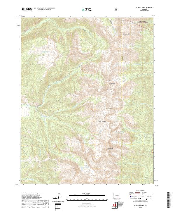
2022 Map of El Valle Creek
USGS Topo · Published 2022About this map
Culebra Range summits dominate the high-altitude landscape of this Costilla County survey, where the peaks of the Sangre de Cristo Mountains form a natural barrier at the border of Las Animas County. The terrain is defined by extreme relief, from the sharp crest of Beaubien Peak and Francisco Peak to the hidden basins containing Carneros Lake and Strawberry Lake. High passes like Whiskey Pass provide the only breaks in the ridgeline, marking historical routes through this mountainous terrain.
Find a feature on this map
31 named features on this map. Tap any name to fly to it.
Don’t see what you’re looking for? This feature index may not catch every label — zoom into the map to look around manually.
Map Details
Editions of this 2022 El Valle Creek Map
This is the sole edition of this map. No revisions or reprints were ever made.
Other maps of this area

1954 · Trinidad
USGS Topo · 1:250,000

1955 · Trinidad
USGS Topo · 1:250,000

1958 · Trinidad
USGS Topo · 1:250,000

1959 · Trinidad
USGS Topo · 1:250,000

1967 · La Valley
USGS Topo · 1:24,000

1967 · Ojito Peak
USGS Topo · 1:24,000
1967 · Cucharas Pass
USGS Topo · 1:24,000

1967 · Taylor Ranch
USGS Topo · 1:24,000
1967 · Stonewall
USGS Topo · 1:24,000
1967 · Culebra Peak
USGS Topo · 1:24,000