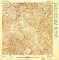
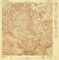
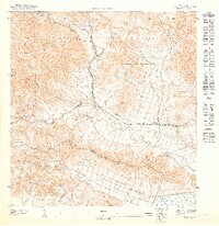
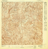
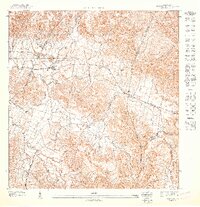
1947 Map of El Yunque SE
USGS Topo · Published 1947About this map
Sierra de Luquillo peaks dominate this mid-century preliminary survey, capturing the high-altitude terrain of the Caribbean National Forest before major modern development. The map details the complex drainage system of the mountain range, where the headwaters of the Río Grande de Luquillo, Río Fajardo, and Río Blanco descend through sharp elevation changes. Geographers and historians will find significant interest in the early recreational infrastructure of the area, including the Area Recreo de la Mina and the established Ranger Station near Mte Britton. Significant landmarks like Pico El Yunque and Roca El Yunque are precisely plotted, showing the trail and summit topography of one of the Caribbean's most distinctive ecological zones. The presence of a Mina in the northeast quadrant points to localized resource extraction occurring within the forest boundaries during this era.
Find a feature on this map
25 named features on this map. Tap any name to fly to it.
Don’t see what you’re looking for? This feature index may not catch every label — zoom into the map to look around manually.
Map Details
Editions of this 1947 El Yunque SE Map
This is the sole edition of this map. No revisions or reprints were ever made.
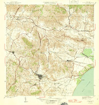
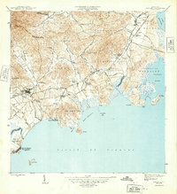
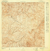
Other maps of this area

1945 · El Yunque
USGS Topo · 1:30,000

1946 · El Yunque
USGS Topo · 1:30,000
1946 · Humacao
USGS Topo · 1:30,000
1946 · Naguabo
USGS Topo · 1:30,000

1946 · Fajardo
USGS Topo · 1:30,000
1947 · El Yunque SO
USGS Topo · 1:10,000
1947 · El Yunque NE
USGS Topo · 1:10,000
1947 · Humacao NE
USGS Topo · 1:10,000
1947 · El Yunque NO
USGS Topo · 1:10,000
1947 · Humacao NO
USGS Topo · 1:10,000