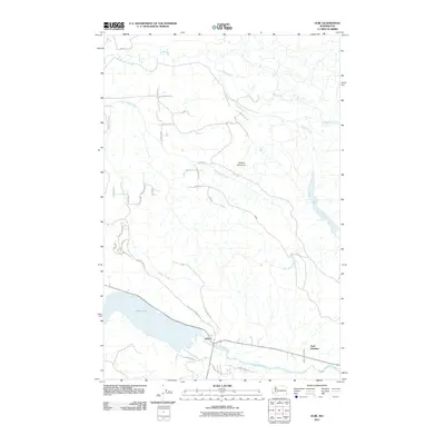
2011 Map of Elbe
USGS Topo · Published 2011About this map
Elbe stands at the convergence of the Nisqually River and the northern shores of Alder Lake, serving as a gateway to the mountains in the early 21st century. This survey documents the intricate drainage network of the south Puget Sound uplands, where the Mashel River and its tributary, the Little Mashel River, carve through the terrain beneath Dobbs Mountain. The settlement of Park Junction marks a key crossroads east of the lake, where local transit routes like Park Junction Rd meet the river valley corridor. The landscape is defined by a hybrid of water-driven geography and a complex grid of forest and residential roads, including Fletcher Mashell Rd E and Midway Creek Rd E. These routes suggest a pattern of rural residential expansion and timber management typical of the Pierce County foothills during this era, while the presence of the Elbe Dump Rd and Elbe Truck Trl indicates the functional, working nature of the land surrounding the community.
Find a feature on this map
31 named features on this map. Tap any name to fly to it.
Don’t see what you’re looking for? This feature index may not catch every label — zoom into the map to look around manually.
Map Details
Editions of this 2011 Elbe Map
This is the sole edition of this map. No revisions or reprints were ever made.
Other maps of this area

1937 · Eatonville
USGS Topo · 1:125,000

1941 · Tanwax Lake
USGS Topo · 1:62,500

1944 · Ohop Valley
USGS Topo · 1:62,500

1949 · Ohop Valley
USGS Topo · 1:62,500

1953 · Hoquiam
USGS Topo · 1:250,000

1956 · Mineral
USGS Topo · 1:62,500

1956 · Kapowsin
USGS Topo · 1:62,500

1957 · Hoquiam
USGS Topo · 1:250,000

1957 · Morton
USGS Topo · 1:62,500

1958 · Hoquiam
USGS Topo · 1:250,000