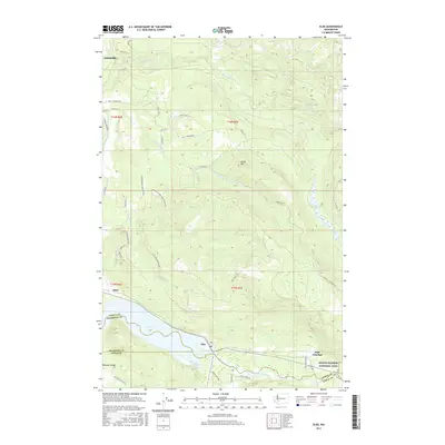
2017 Map of Elbe
USGS Topo · Published 2017About this map
The Nisqually River valley anchors this area, where the water flows through the small community of Elbe at the intersection of several regional roads. In the southern reach of the map, the river feeds into Alder Lake, a significant water body that dominates the southwestern corner near the settlement of Alder. The landscape rises sharply from the riverbanks toward Dobbs Mtn and into the western edge of Mount Rainier National Park at Park Junction. To the north, the terrain is defined by the winding paths of the Mashel River and the Little Mashel River, which carve through the foothills near the outskirts of Eatonville. A network of forest roads and trails, such as the Eatonville Elbe Forest Patrol Rd E and Elbe Truck Trl, indicates the heavy integration of forestry and conservation within this Pierce County corridor.
Find a feature on this map
41 named features on this map. Tap any name to fly to it.
Don’t see what you’re looking for? This feature index may not catch every label — zoom into the map to look around manually.
Map Details
Editions of this 2017 Elbe Map
This is the sole edition of this map. No revisions or reprints were ever made.
Other maps of this area

1937 · Eatonville
USGS Topo · 1:125,000

1941 · Tanwax Lake
USGS Topo · 1:62,500

1944 · Ohop Valley
USGS Topo · 1:62,500

1949 · Ohop Valley
USGS Topo · 1:62,500

1953 · Hoquiam
USGS Topo · 1:250,000

1956 · Mineral
USGS Topo · 1:62,500

1956 · Kapowsin
USGS Topo · 1:62,500

1957 · Hoquiam
USGS Topo · 1:250,000

1957 · Morton
USGS Topo · 1:62,500

1958 · Hoquiam
USGS Topo · 1:250,000